Here are some scanned in maps for looking at and possibly experimenting with. They don't contain traffic solutions, though the one contains some information about traffic measurements. Each map (except the MapBlast street map) has a low and high resolution form. The high resolution forms were scanned in at 300 dpi. The lower resolution forms were sampled down to a point where they seem reasonable size for an Internet transfer at 28.8 kbps and so that they might be printable directly from a Web browser. Suit yourself.
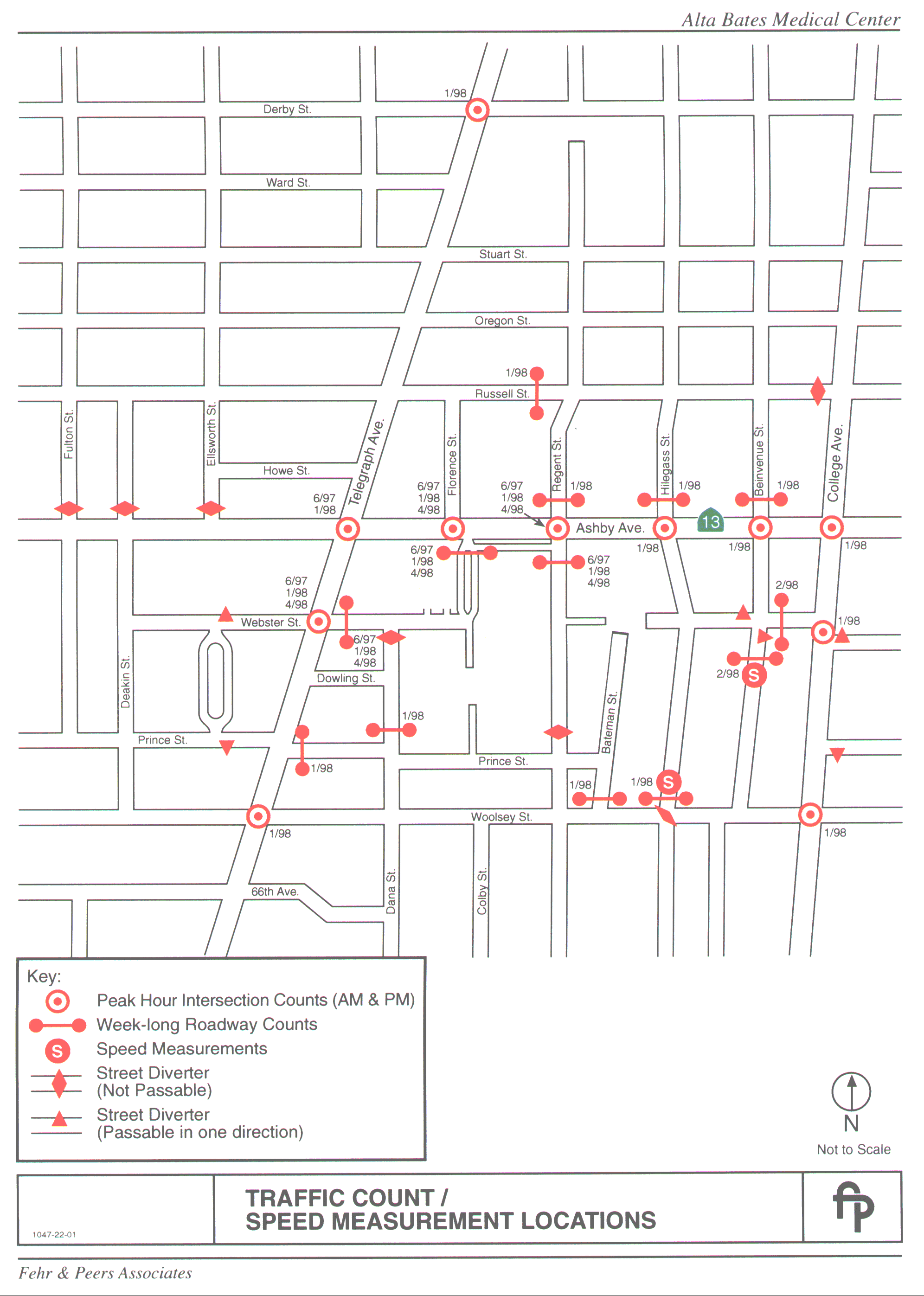
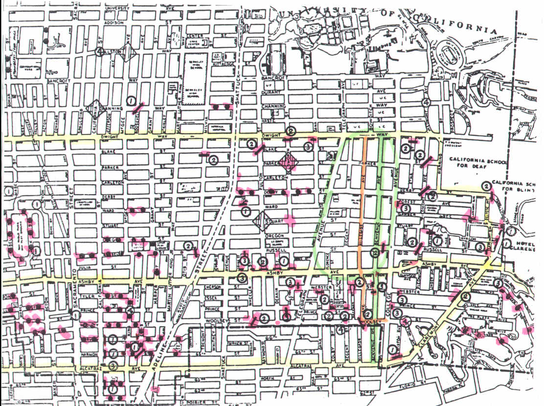
Traffic Count/Speed Measurement Maps:
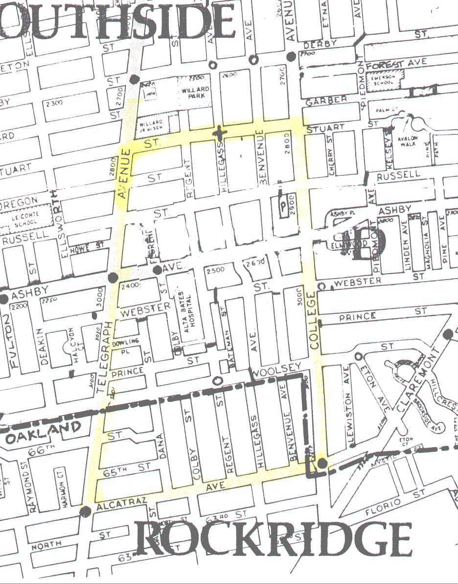
Area Street Map with block addresses, some barriers, etc.:
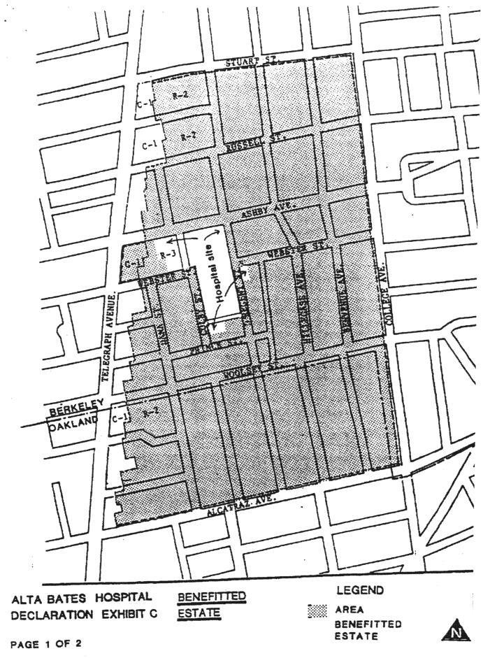
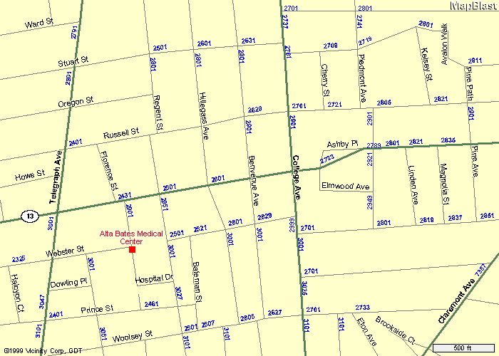
Alta Bates Declaration Exhibit:
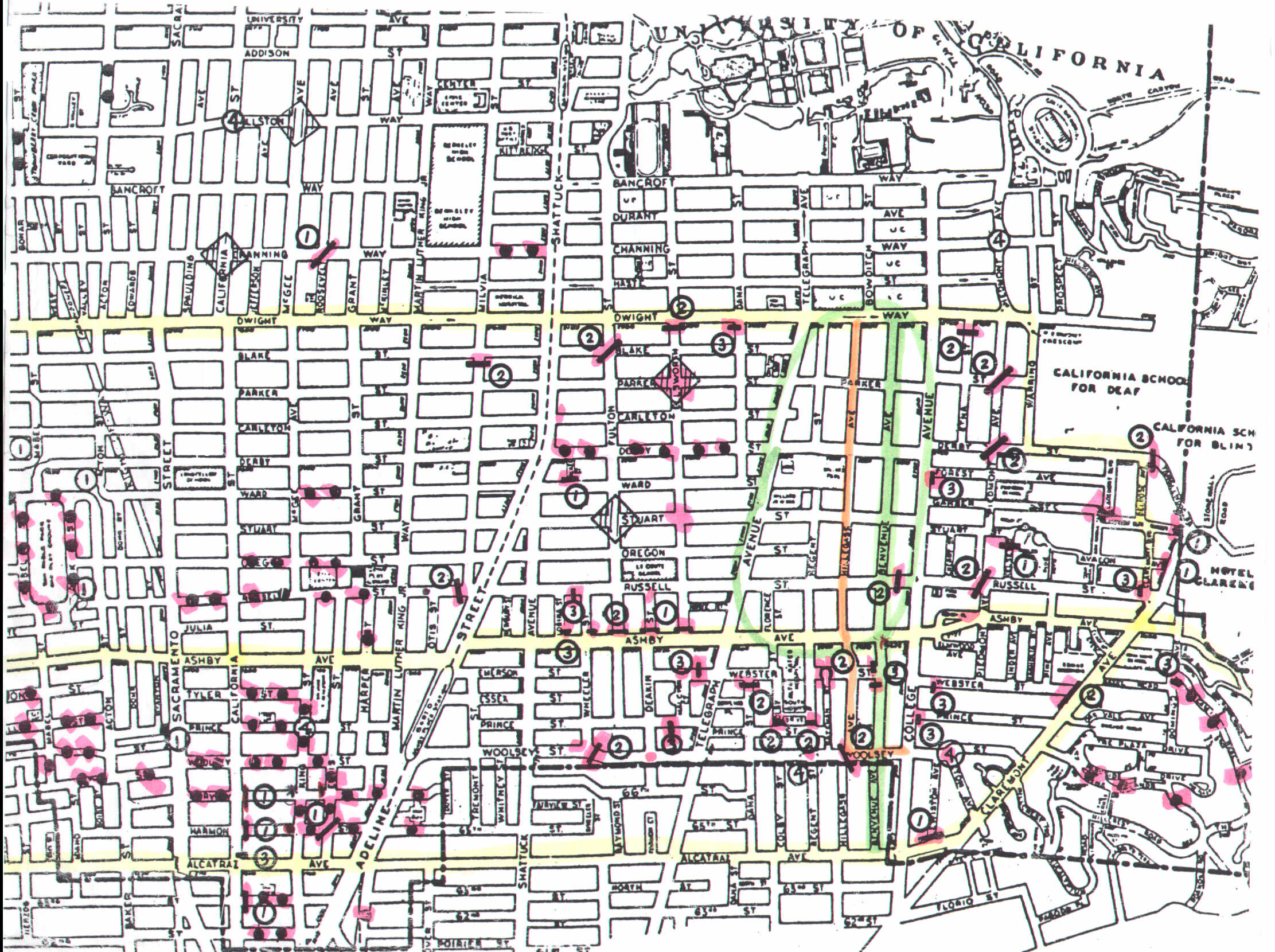
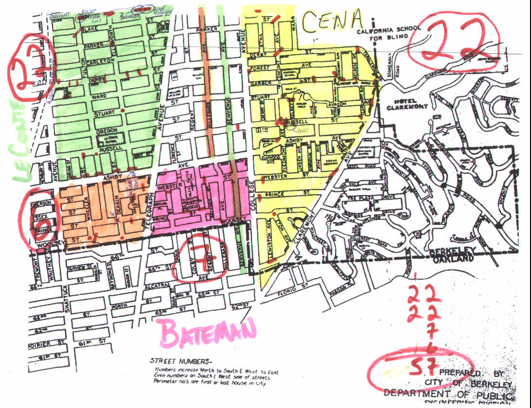
Paul Tuleja's map of traffic control devices in the area:
MapBlast street map (17 KB)
Link to Yahoo interactive map -> College & Ashby
We could also likely get a decent street map from the Census Bureau's "Tiger" database without any copyright restrictions, but it would come without labels (e.g. street labels) of any kind.
Map originals from Marty Barclay, scanned and processed to this HTML form by Jed Donnelley